
Surface water modelling
Will there be water when the project needs it, and how often might there not be? We build the model that answers that.
Why rainfall records can mislead
Rainfall in southern and central Africa swings a lot from year to year. A site can look fine after a few good seasons and still run short in a dry spell. What matters for a dam, a pump station or an irrigation scheme is how often the water is there across wet and dry years alike.
What we do
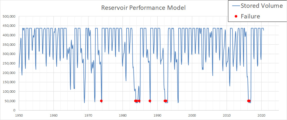
We build a rainfall-runoff model for your catchment, using decades of data, and run it to find out how often a given supply can be met. The result is a measured level of risk, in place of a best guess.
Each model is built for the site and refined as we go, with your input. We want you to understand how it works and what drives the results.
Working where data is thin
Most of our work is in countries north of South Africa, where river gauges are scarce and long records are hard to get, expensive, or can't be trusted. Our methods are set up for those conditions.
What you get
- Risk curves that show how often water will be available
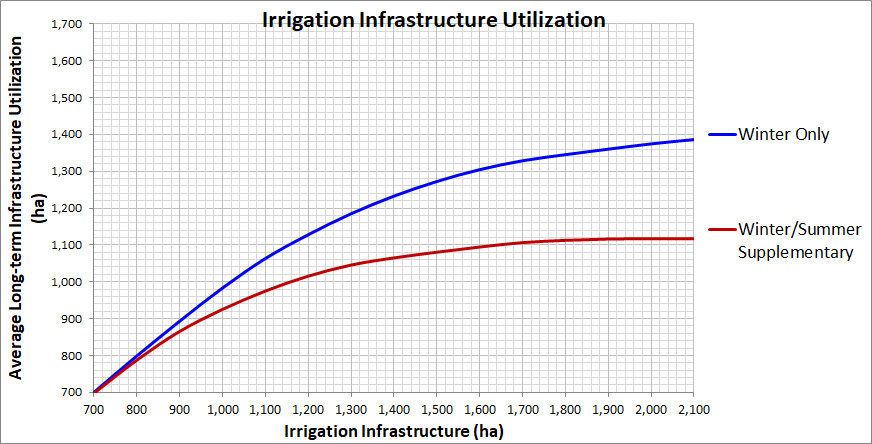
- Supply reliability charts you can use when sizing and phasing a project
- A model built for your catchment, not a generic one
- Numbers you can put in front of lenders, partners and regulators
Looking further ahead
If the project needs to hold up over decades, we can run bias-corrected climate change projections through the same model to see how supply might change. More on climate change analysis.
Need to know how reliable your water is?
Send us the location and a few lines about the project and we will tell you what we would do.